
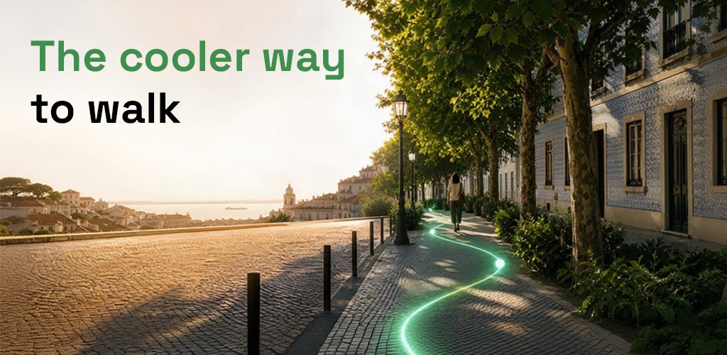
GreenRah launched: the cooler way to walk in the shade
Founder of GreenRah
GreenRah launched. It is a free walking planner for pedestrians who want to walk in the shade, avoid the harshest streets in a heatwave, or find a gentler path with less slope and fewer stairs. Heat Smart shows the coolest way. Accessible shows the gentle way. The brand tagline is The cooler way.
The web app is in beta after two weeks of alpha. Open it at greenrah.com/app. Android and iPhone apps are due in September 2026. If you have an idea, send it on greenrah.featurebase.app.
What GreenRah is
GreenRah is a pedestrian map, not a car navigator. You set an origin and a destination, pick a time, and ask for a walk. The engine reads weather, the sun in the sky, the height of buildings and the shade they throw, slope, stairs, and the real walking network: pavements, pedestrian streets, parks, and other green places. Those signals are weighted into one comfort score, then turned into a route you can follow.
Anyone can use it. You do not need an account to plan a walk. Accounts help if you want saved places and a longer planning window. There is no paid wall on Heat Smart or Accessible. The app is free for everyone.
The problem
Heat in Europe is no longer a rare summer story. People die in heatwaves. Pavements bake. The shortest line on a map often runs through open asphalt, a steep climb, or a staircase in full sun. Tourists, seniors, parents with children, and anyone on foot still have to move through the city. Most navigation tools were built for vehicles. They treat the street as a corridor for cars. They do not ask whether the walking side of that street is in shadow, whether the path cuts through a park, or whether the next block is a flight of stairs.
That gap is the reason GreenRah exists. If we want walking to stay possible in hot months, the map has to care about shade, slope, and people, not only travel time.
How it started
The GreenRah project began in May 2026. I kept coming back to a simple observation: people in Europe, especially, are dying because of heat, and that is a reason to act. Google Maps and other navigation apps still centre cars and the carriageway. Pedestrians are an afterthought. The idea that stuck was to put people first and use the shadows of buildings, plus parks and pedestrian paths, as the raw material for a walk.
I wrote a first draft, then a clearer product and business model, then an MVP. After more development, GreenRah became a company registered in Estonia (GreenRah OÜ). The web application now runs well. This post is the public launch note.
Heat Smart and Accessible
GreenRah has two planning modes besides a fastest walk.
Heat Smart is for hot hours and heatwaves. It looks for walking in shade: building shadow, tree cover where we have it, and streets that stay off the worst sun. The result is labelled the coolest way. Time of day matters. Morning shade is not afternoon shade. Building height matters, because a tall frontage throws a longer shadow. The sun’s place in the sky is part of the model. Weather is part of the model too. On a cloudy day, harsh direct sun is weaker, so Heat Smart does not hunt shade the same way it does under a clear sky.
Accessible is for people who need a gentler walk. We collected slope data across the cities we cover. The mode prefers lower gradient, avoids known stairs, and still pays attention to shade. You get a path between the same origin and destination that is easier on knees, joints, wheels, and strollers. It is not a medical certificate and it cannot see every temporary barrier, but it is built to reduce steepness and steps when the map knows them.
Both modes run on a walking graph, not a driving graph. Some segments are pedestrian-only. Some cut through parks and other green places. Those links are in the model so a “shadow route” can leave the main road when a cooler or gentler footpath exists.
Read the User Guide for the day-to-day steps: What is GreenRah? and Heat Smart vs Accessible.
Who it is for
Parents and caregivers
A heatwave with a small child is not a normal errand. Prams heat up. Toddlers stop. Crossing a treeless square at noon can end the outing. Parents need a walking planner that prefers shade and, when the traveller type is a stroller, a path that does not dump them onto stairs. Heat Smart keeps more of the walk in shadow. Accessible looks for the gentle way so the route is not a sequence of steps and steep kerbs. The goal is a trip you can finish, not a fastest-time trophy.
Everyday pedestrians
Most city trips on foot are short: school, the shop, the office, the tram stop. In summer those same blocks become a choice between arriving soaked in heat or taking a longer way you cannot see on a car map. Pedestrians feel radiant heat from asphalt, standing traffic, and unshaded facades. GreenRah is for that daily walk. You plan a shaded walking route for the hour you will actually leave, then follow it. Distance can grow a little. Comfort is the point.
Seniors
Older walkers are among the people heat hits hardest. Recovery from a steep hill is slower. Direct sun raises strain. Stairs that a routing app ignores are not a detail; they can be the reason someone stays home. Accessible mode is built for that reality: lower slope, fewer stairs, still aiming for shade. Heat Smart helps when the day is simply too bright. Neither mode replaces a doctor or a rest in a cool room. Both give a map that respects the body on the pavement.
Tourists and people exploring a new city
Visitors who land in a country they do not know cannot “just take the shady side.” They do not know which street has a canyon of buildings, which park is a shortcut, or which hillside is a trap. City sightseeing is walking. A day of museums, viewpoints, and old towns in a heatwave without a shade-aware plan is exhausting. GreenRah is a walking planner for that trip: origin, destination, Heat Smart, coolest way. Use it to stitch visits together, to walk from the station to the centre, and to keep exploring instead of retreating to air-conditioned corridors. Komoot is strong for outdoor sport. Citymapper is strong for mixed public transport. Google Maps is strong for driving and generic directions. GreenRah is for the pedestrian who is new to the city and needs shade and slope in the same plan.
Runners and people training outside
Summer training on the hottest line between two parks is a bad session. Runners search for shadow routes, tree-lined loops, and paths that stay off open tarmac. Heat Smart will not replace a coach, but it will bias the line toward shade for the hour you set. Accessible is usually the wrong tool for a workout unless you want a recovery jog with less climb. For heat, pick Heat Smart, pick the time of day, and treat the coolest way as the session’s map.
Workers on foot and anyone who cannot skip the walk
Delivery on foot, site visits, commuting without a car, and school runs in August all share the same constraint: the walk is not optional. Those groups need the same two answers. Where is the shade? Where is the gentle grade? GreenRah is built so you can ask both without switching to a specialist research tool.
Where it works
Heat Smart and Accessible walks work across the European Union and Great Britain, plus Norway, Iceland, Switzerland, and Liechtenstein. In the EU that is Austria, Belgium, Bulgaria, Croatia, Cyprus, Czechia, Denmark, Estonia, Finland, France, Germany, Greece, Hungary, Ireland, Italy, Latvia, Lithuania, Luxembourg, Malta, the Netherlands, Poland, Portugal, Romania, Slovakia, Slovenia, Spain, and Sweden. Great Britain here means England, Scotland, Wales, and Northern Ireland.
If a start or end point sits outside that coverage, the app can still show a fastest walk. The cooler and gentler modes need the shade and slope layers we ship for those countries.
Why it is different
Google Maps, Komoot, and Citymapper are good at what they were built for. Driving, turn-by-turn, trail sport, and city transit are not the same job as a pedestrian shade model. GreenRah does not try to replace a car ETA or a hiking GPX. It answers a narrower question: for this origin, this destination, and this hour, which walking line is the coolest way, and which line is the gentle way?
The difference is the stack. Building height feeds shadow. Sun position feeds when that shadow falls. Weather, including cloud, changes how aggressive solar load is. Slope and stair data feed Accessible. Pedestrian paths and parks feed the graph so the route can leave the traffic street. Those layers are weighted into one comfort score instead of being five separate maps you have to read by eye.
That is also why a tourist can use it in a city they have never walked. The model does not assume local knowledge. It assumes you want walking in the shade, a walking planner that respects heat, and a result you can open on the web today.
Mission, vision, and goals
Mission. Make walking in hot and hilly cities safer and more realistic by putting shade, slope, and pedestrians at the centre of the route, not at the edge of a car map.
Vision. The cooler way as a habit: when someone searches for a shaded walking route, a shadow route, or a walking planner for heat, GreenRah is the clear answer, first on the web and then in the pocket on Android and iPhone.
Goals. Keep the web app free. Ship Android and iPhone in September 2026. Improve the model city by city. Add features from a clean roadmap without locking Heat Smart or Accessible behind a paywall. Listen to testers. Stay honest about what the map knows and what it cannot see on the ground.
From alpha to beta
We published the web application in alpha for two weeks. Testers used it, sent ideas, and helped us find bugs. GreenRah is now in beta. It works well enough to use for real walks, and we are still watching edge cases: missing stairs, odd graph links, and hours when shade data is thin. Beta is the right word. It is not a promise that every street is perfect.
What comes next
The roadmap for the web app is already written. More features will land in sequence, not as a pile of switches. Android and iPhone follow in September 2026. If something is wrong, or you want a city behaviour we do not have yet, send it on greenrah.featurebase.app.
GreenRah launched so people can walk the cooler way. Open the beta, plan a Heat Smart shade route or an Accessible gentle walk, and tell us what to improve.
Questions people ask
What is GreenRah?
GreenRah is a free pedestrian walking planner. Heat Smart finds cooler, shadier walks. Accessible finds gentler paths with less slope and fewer stairs. The brand tagline is The cooler way.
Where does GreenRah work?
Heat Smart and Accessible walks cover the 27 EU countries plus Great Britain, Norway, Iceland, Switzerland, and Liechtenstein.
Is GreenRah free?
Yes. The web app is free for everyone. Open it at greenrah.com/app.
What is Heat Smart versus Accessible?
Heat Smart returns the coolest way: more shade and lower sun load for the time you pick. Accessible returns a gentler way: lower slope and fewer stairs between the same origin and destination.